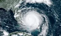
Aerial photos captured the devastation wrought by Hurricane Dorian in Marsh Harbour, located on Grand Abaco Island in the Bahamas.
The photos showed ruins as far as the eye could see, including trees bent in half or entirely stripped. Houses appeared to have been leveled while rubble emerges from the storm surge flood.
Here are some new pictures of the damage in #MarshHarbour #Mudd #Abaco..#dorian
Dorian#HurricaneDorain pic.twitter.com/T4Cy1yeo31— Rob Lando ?️? (@DCRobMan) September 3, 2019
This is one of the worst hit spots in #MarshHarbour Locals say it’s called the “Mud” and that it has a large population of Hatian immigrants. Hopefully they evacuated to a shelter bc the damage is catastrophic there. #TheBahamas @accuweather @breakingweather pic.twitter.com/GxsaLU4sAI
— Jonathan Petramala (@jpetramala) September 3, 2019
According to Fox13’s Mark Wilson, an airport on Grand Abaco Island was totally covered in water.
PHOTO: Airport in Bahamas, fully covered in water. Believed to be Marsh Harbour. Pic courtesy USCG Air Station Clearwater taken 09/02/19 #Dorian pic.twitter.com/1z4xbkgfyX
— Mark Wilson FOX13 (@MarkWilsonTV) September 3, 2019
Dorian spent more than 24 hours hovering over Abaco Island and Grand Bahama Island before it began to move on Tuesday, Sept. 3.
The National Hurricane Center (NHC), in its 3 p.m. update, said that Dorian is now moving away from Grand Bahama, leading to tropical-storm-force winds along the Florida coast.
“The eyewall of Dorian continues to move away from Grand Bahama Island. However, dangerous winds and life-threatening storm surge will continue over that island through this evening,” the agency said.
#Breaking – 4 #USCG #Jayhawk helicopter crews medevaced 19 people from the #MarshHarbour Clinic to Nassau International Airport to EMS. Read more details here: https://t.co/Jg3bOXbdYy #USCGDorian #Dorian #HurricaneDorian pic.twitter.com/psuOsokeeC
— USCGSoutheast (@USCGSoutheast) September 3, 2019
At 2 p.m., the agency said Dorian is moving 5 mph to the northwest.
“A turn toward the north is forecast by Wednesday evening, followed by a turn toward the north-northeast Thursday morning. On this track, the core of extremely dangerous Hurricane Dorian will gradually move north of Grand Bahama Island through this evening,” the NHC added.
“The hurricane will then move dangerously close to the Florida east coast late today through Wednesday evening, very near the Georgia and South Carolina coasts Wednesday night and Thursday, and near or over the North Carolina coast late Thursday and Thursday night. Data from reconnaissance aircraft indicate that the maximum sustained winds remain near 110 mph with higher gusts. Dorian is expected to remain a powerful hurricane during the next couple of days,” the NHC wrote.