Two volcanoes have been imaged by the Advanced Land Imager (ALI) on NASA’s Earth Observing-1 (EO-1) satellite.
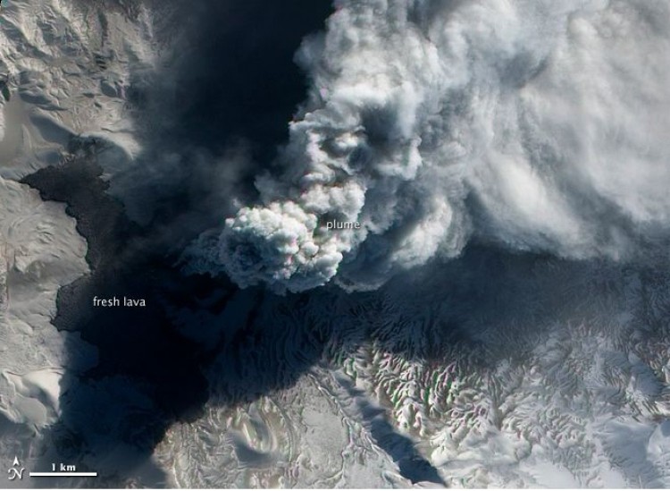
Puyehue-Cordón Caulle in Chile, which began erupting on June 4, continues to send out ash into the atmosphere.
ALI captured a picture of the volcano on July 31 with a pale ash plume rising, shadowing the lava flow beneath, during a minor eruption. Ground cameras showed the eruption column reached one mile (two kilometers) in height.
South of the plume in this image, areas free of lava are covered with a branching pattern of white snow and brown ash.
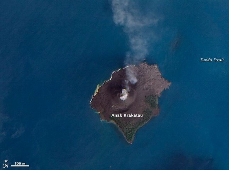
On the same day, the satellite acquired an image of Anak Krakatau in the Sunda Strait in Indonesia, showing a thin plume of ash drifting westwards.
The name of this little volcano literally means "Son of Krakatoa," and was the site of one of the biggest eruptions in the 19th century.
Dark gray areas on the island mostly comprise lava flows from the 1970s through to the 1990s, and vegetation is growing on the older flows along the eastern side.